LiDAR & Point-Cloud Production
iTech Group produces digital 3D models of terrain, buildings, industrial sites and linear infrastructure using high-precision LiDAR technology and modern geospatial solutions. LiDAR sensors capture millions of measurement points to create a high-accuracy digital representation of the environment; the data is processed into point clouds, digital terrain models (DTM), digital surface models (DSM), orthophotos and other 3D geospatial models.
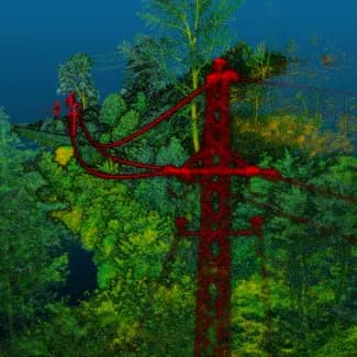
For power transmission and distribution networks we carry out aerial surveys with integrated GNSS-supported LiDAR and high-resolution camera systems. A single flight yields both a high-density point cloud and high-quality orthophotos, producing a digital 3D model that captures the line, pylons, vegetation, structures and surroundings with full precision.
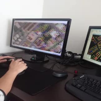
From the 3D model, safety clearances between power lines and vegetation, buildings and other objects are calculated automatically, line sag is analyzed in a three-dimensional environment, and fault-risk zones are reported early with their coordinates. All data integrates with BIM, GIS, CAD and other engineering platforms, forming a single digital base for planning and long-term project management.
LiDAR + orthophoto
Integrated GNSS-supported capture produces point clouds and orthophotos in one pass.
Proximity reporting
Multi-directional clearance to vegetation and structures, with trees inside legal limits flagged.
Line-sag tracking
Field data is examined in 3D and dangerous sag is auto-reported by location.
LiDAR + orthophoto
Integrated GNSS-supported capture produces point clouds and orthophotos in one pass.
Proximity reporting
Multi-directional clearance to vegetation and structures, with trees inside legal limits flagged.
Line-sag tracking
Field data is examined in 3D and dangerous sag is auto-reported by location.
Benefits
A precise, measurable 3D model of the whole corridor
Vegetation and clearance risks quantified, not estimated
Dangerous line sag flagged by location before it fails
One flight delivers both LiDAR and orthophoto deliverables
Technologies
Our Strategic Technology Partners



































Let's deliver your next project together
Share your project requirements with us. Our specialists will assess the solutions that fit your needs and get back to you shortly.
- Initial response within 1 business day
- Your data kept confidential
- Initial consultation and assessment